MetaCitiAI Urban Mobility Platform
MetaCiti AI transforms city and highway cameras into a live digital map enabling safety alerts, continuous localization, automated incident detection, live congestion mapping, and mobility analytics. All events, alerts, analytics, and flow patterns are provided through an Operator Dashboard.
Trusted by industry leaders
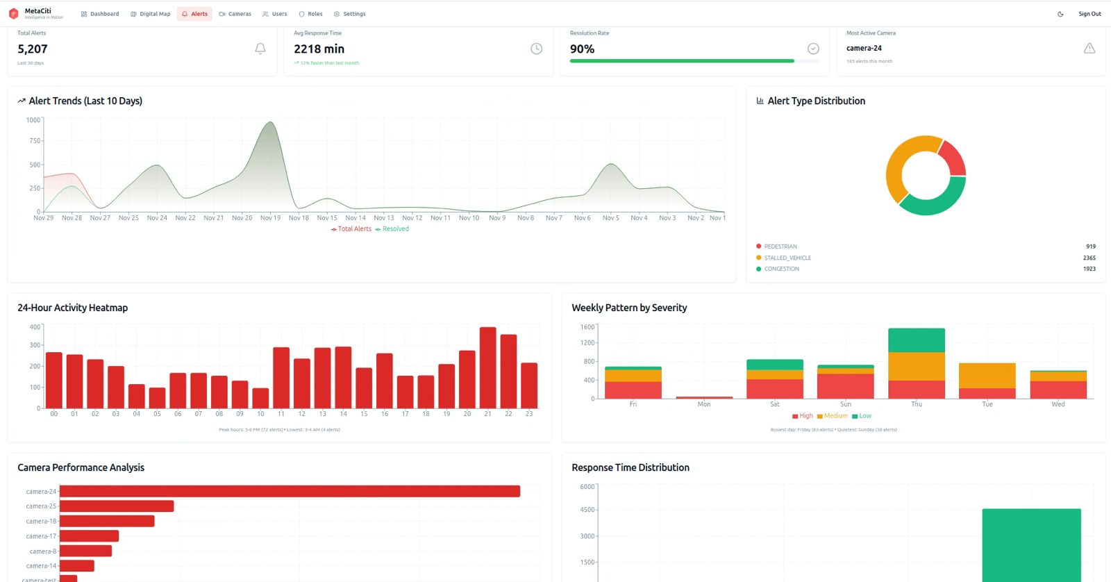
Automated Incident Detection & Analytics
From incident detection to predictive analytics, MetaCiti delivers the intelligence you need to manage urban mobility.
Stalled Vehicles & Lane Blockages
Debris & Roadway Hazard Detection
Wrong-Way & Risky Driving Detection
Flow Analytics
Near-Miss & Conflict Analytics (Vision Zero)
Traffic Flow & Speed Analytics
Congestion Maps & Bottleneck Analysis
Multimodal Movement Tracking
Intersection Performance Monitoring (ATSPM)
Transit Priority & Service Reliability Support
Emergency Vehicle Priority Support
Event Replay & Incident Review
Real-time operational decision support for transportation networks
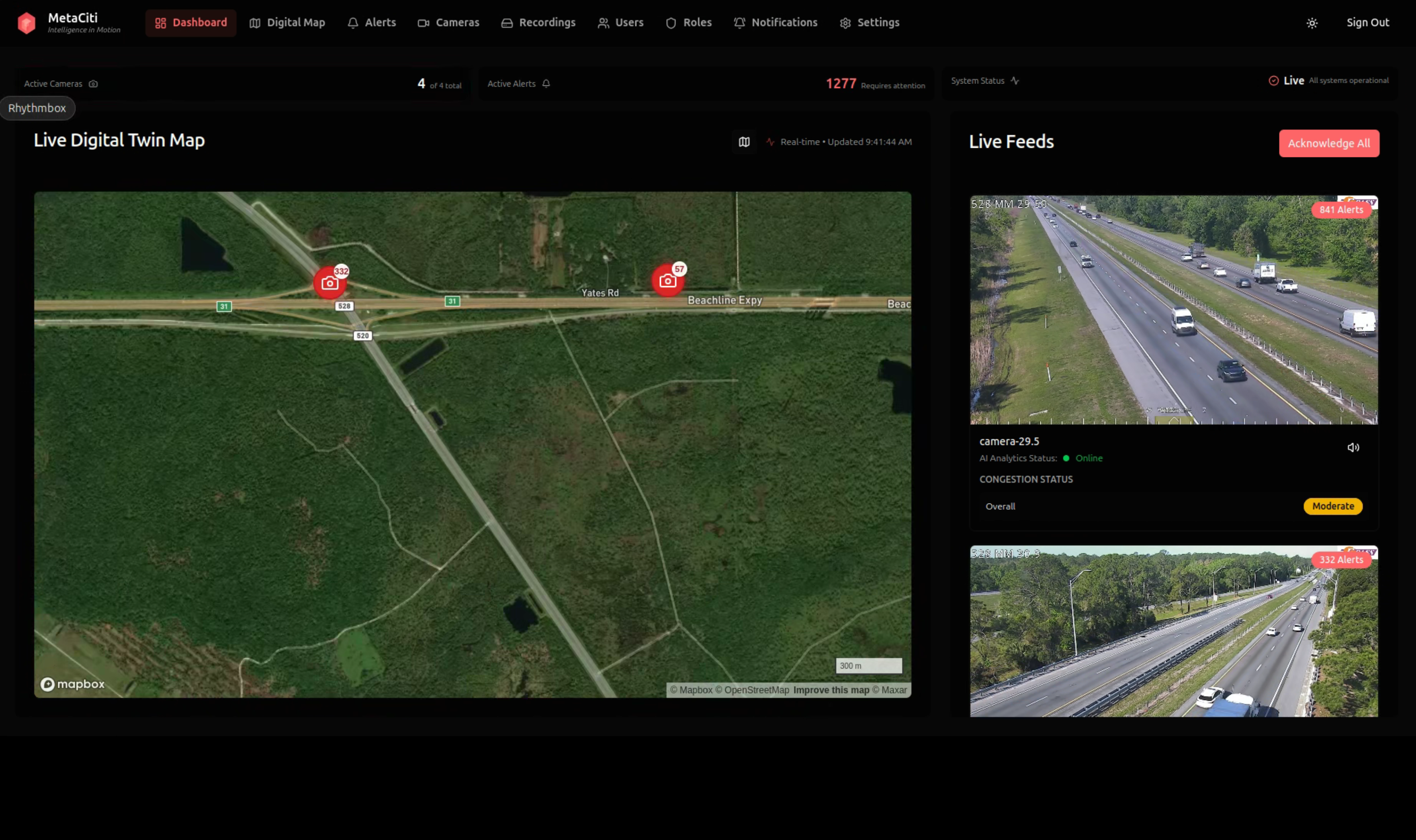
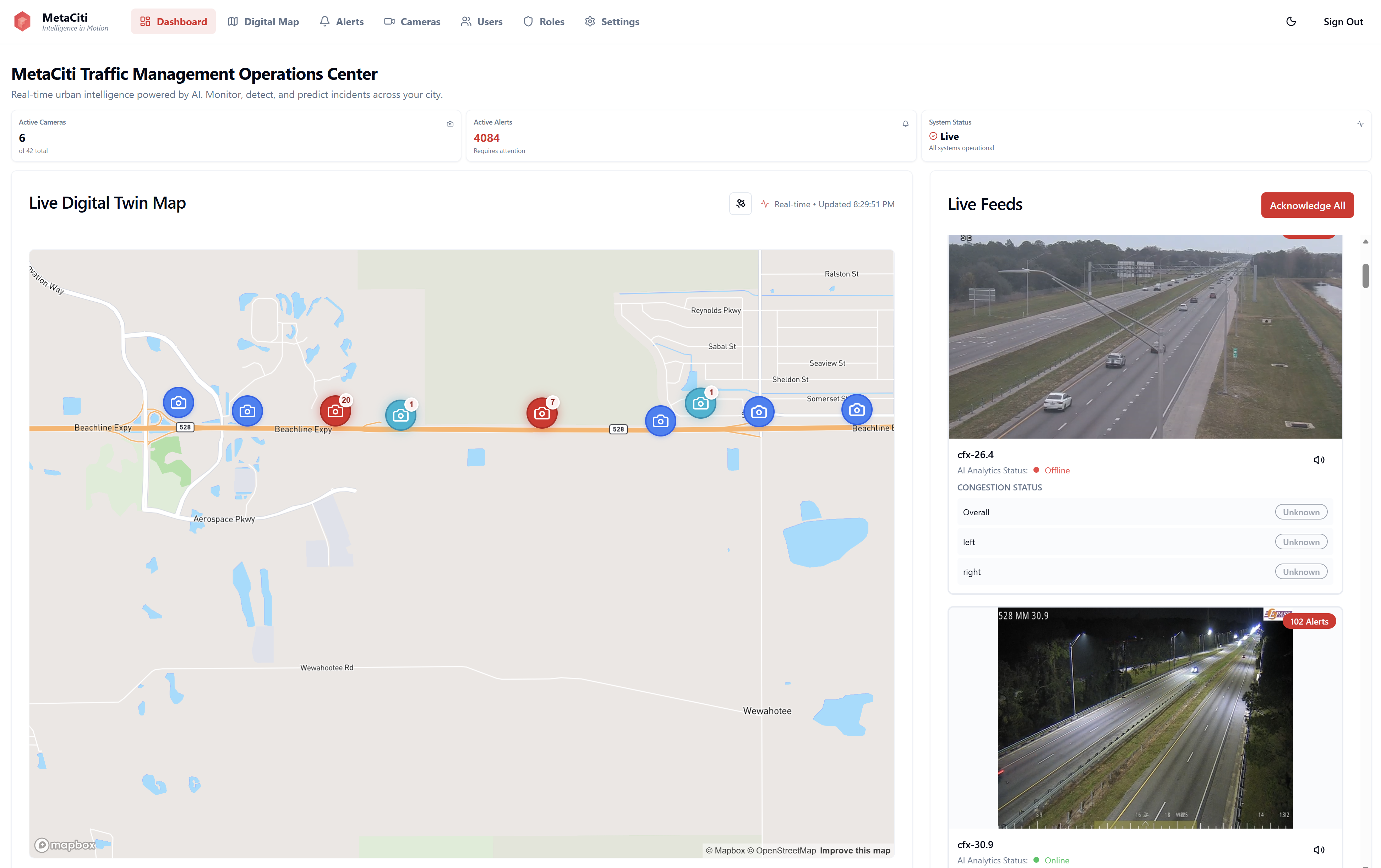
Supporting transportation agencies and system integrators with live digital twin operational views, real-time monitoring, and incident detection across intersections and corridors to support traffic management and incident response.
A single operational interface for traffic and mobility management
A live digital twin–based interface supporting real-time monitoring, incident response, and operational decision support across transportation networks.
"The dashboard scales easily from a single site to district or citywide deployments, providing seamless integration with existing infrastructure and workflows."
Transform Urban Mobility with Intelligent Insights
Faster Response
Faster incident response and resource deployment
Safer Streets
Safer, more reliable streets for all road users
Optimized Operations
Optimized transit operations and fleet management
Data-Driven Planning
Data-driven infrastructure planning and investment decisions
From Cameras to Operational Intelligence
MetaCiti works with existing roadway infrastructure to provide AI-driven traffic awareness.
Connect Infrastructure
Integrate roadway cameras and selected sensors into the MetaCiti platform.
AI Interprets Activity
AI models analyze traffic flow, incidents, and movement patterns.
Operators Receive Alerts
Traffic operators see alerts, analytics, and digital twin visualization.
Ready to Transform Your City's Mobility?
See how MetaCiti can help you improve safety, optimize operations, and make data-driven decisions for your urban network.